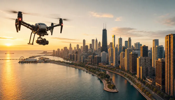
Most skylines look impressive from the air. The harder question is which part of a city belongs in a specific video, and how that choice changes what the footage is actually able to do for a brand. Choosing aerial filming locations in Chicago is less about chasing one famous view than about matching a place to a message: a shoreline that opens a story, a river that adds vertical scale, or a business district that quietly signals who the audience is.
Chicago offers an unusually wide range of options inside a compact area. The city sits on the western shore of Lake Michigan and is the third-most populous city in the United States, so the visual library available to a local production is deep: open water, dense architecture, working corridors and neighborhood texture all within a short drive of one another. For a readable city profile and geographic context, Chicago on Wikipedia and the Census Reporter profile for Chicago are useful starting points. The sections below explain how each environment behaves on camera and what to settle before a shoot date is locked.
Why Aerial Footage Reads Differently Along the Lakefront
Water is the most useful editing tool a city like this gives a filmmaker. A lakefront shot comes with a built-in horizon, a large area of calm negative space and a natural direction of travel, which means a single pass can open a video, establish scale and hand the viewer off to the next scene without a hard cut. For companies whose story is about openness, growth or reach, the shoreline does a lot of that work before a single line of voiceover lands.
The trade-off is that a lakefront is the most heavily used aerial backdrop in any lake city, so the difference between generic and specific usually lives in the details: which segment of shore you fly, what else is in frame, and the time of day you commit to. A stretch of coast with a recognizable park, harbor or stadium cluster reads as a place. An anonymous band of water and towers reads as stock.
Light and Wind Set the Working Window
Because the city faces east across the water, early light tends to arrive from over the lake, which usually produces softer contrast on buildings that front the shoreline. Later in the day the same geometry reverses and the skyline can fall toward silhouette while the water stays bright. Both versions are useful, but they say different things, and that difference is worth deciding in advance rather than discovering on set.
Wind deserves the same respect. Open water means fewer obstructions and more sustained gusts, so a shoreline shoot is a good candidate for an early call time, when air is frequently calmer and the light is still doing something interesting. It also means a weather contingency is not pessimism — it is part of the schedule.
Building a Shot List That Travels
A strong lakefront sequence usually moves in one direction instead of hopping between landmarks. Plan the order as a path: an establishing wide, a mid-range pass that follows the curve of the shore, a tighter frame on one architectural anchor, and a closing shot that pushes out toward open water. Shooting that path in a single session keeps the light consistent across shots that will later be cut next to each other.
The River Corridor as a Vertical Backdrop
If the lakefront is about width, the river corridor is about height and motion. Towers on both banks create a canyon, bridges frame the view at regular intervals, and the water itself carries a constant line of movement. That combination makes the river a strong choice when a video needs to feel urban, active and dense — a commercial for a downtown employer, a hospitality brand, or a company that wants to place itself inside the energy of the city rather than above it.
The corridor is also less forgiving. Tall buildings throw long shadows across the water, so the usable light window is narrower than it first appears, and the contrast between sunlit glass and shaded water can be difficult to balance in a single frame. Midday tends to flatten the canyon; earlier and later in the day the light moves across the facades and gives each shot more depth.
Composition Choices Inside a Narrow Frame
Working in a corridor means composing in layers. The nearest bridge can act as a foreground frame, the river supplies a leading line, and the far bank gives the shot a natural end point. Reflected light on the water adds texture that a plain skyline shot cannot replicate. When a brand needs footage that feels unmistakably local without showing a sign or a logo, this is often the most efficient way to get it.
River traffic is the other variable. Tour boats, commercial vessels and kayaks move on their own schedule, which can be an asset — a boat crossing frame adds life to a static composition — or an interruption. Build a little slack into the schedule for any shot that depends on a clean waterway.
Neighborhood Districts and Their Visual Character
The city is not one visual texture. Downtown and the West Loop read as dense, glass-and-steel and commercially confident. The North Side reads as more residential: lower rooftops, tree canopy, side streets and smaller buildings. Riverfront and waterfront corridors blend both. None of these is better than the others; they simply fit different stories.
A quick way to test a district is to ask what the client wants a viewer to feel in the first five seconds. National reach and scale point toward the core. Local credibility, neighborhood connection and everyday familiarity point toward the residential districts. A business that serves a specific corridor will usually get more recognition from footage shot along that corridor than from an anonymous downtown flyover.
That matters for marketing because local viewers recognize their own city at a glance, and recognition does real work: it signals that a business operates in the same place its customers do. It is also why brands in this market end up competing for attention in two directions at once — inside the city and across Cook County. How Chicago brands compete for city and suburban attention covers that split, and how customers in different parts of the city search explains why the district a business prioritizes online rarely matches every neighborhood it serves.
What to Decide Before the Shoot Date
Most location problems are really planning problems. Before a date is booked, the useful decisions are about purpose rather than scenery.
- Where the video will live. A hero website film, a vertical social cut and a short paid ad each demand different framing and pacing, even when they come from the same flight.
- Who owns the shot list. One person should be able to approve or cut shots quickly on the day so the crew is not waiting on a committee.
- Deliverables and formats. Aspect ratios, resolution, color treatment and whether raw files are needed should be agreed before the shoot, not reconstructed after it.
- Weather and rescheduling. A simple written plan for when a flight is called off and how the new date is confirmed removes most of the friction from a weather delay.
- Access and permissions. Aerial work near private property, event venues or the public way should be planned with the property owner or the relevant city process in mind.
Two points deserve explicit mention because they shape what is possible. First, flight planning here has to account for federal and local rules, including FAA Part 107 operations, the city’s small-unmanned-aircraft ordinance, property-owner consent and airport airspace coordination where relevant. Second, some shoots near busy public areas may involve a city permit; the requirement depends on location and scope, so it should be checked per project rather than assumed.
Finally, decide what happens after the flight. Naming the editor, the delivery deadline and the destination channels in advance is what keeps a good shoot from becoming a folder of footage nobody uses.
Turning Location Footage Into Something a Business Can Use
Location footage earns its cost when it gets reused. A single shoreline flight can produce a wide brand sequence, a short social cut, a silent loop for a website header and background plates for a paid campaign. A river corridor pass can supply establishing shots for a recruitment page and detail shots for a hospitality or real estate listing. Planning those derivatives before takeoff is what turns one shooting day into a library.
Seasonality helps as well. Footage captured in summer light and footage captured after the first cold front say very different things, and a business that schedules two sessions a year ends up with assets that stay relevant across the whole calendar instead of going stale in a month.
If you are weighing whether this fits your marketing plan, the most useful first step is a conversation about the story you want to tell and the places that support it. You can plan an aerial shoot with a Chicago video team and get a shot list built around your goals, your locations and the channels you actually use. The same planning logic sits inside the Creaxiones Growth System™, which keeps visual work tied to a broader growth plan rather than to a single deliverable.
Share your objective, the districts or properties you have in mind, and where the video needs to run. With that context, a location plan and a realistic shooting window are usually quick to put together — and if you want to see how local visibility works without a location on every corner, that is how local visibility works without a location on every corner. You can reach the team through the contact page whenever you are ready.